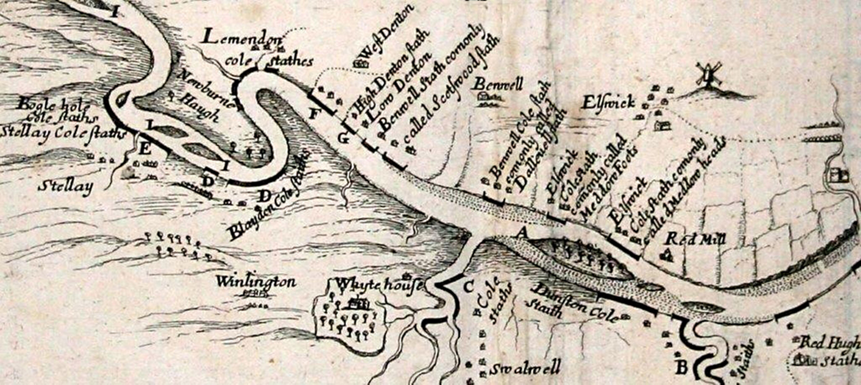
 (1) The western part of a survey of the tidal waters of the River tyne made in 1670 by the Commissioners showing the principal staiths at that time: Stella, Blaydon, Derwenthaugh, Dunston, Team and Redheugh on the south side and Lemington, West Denton, East Denton, Scotswood, Benwell, Delavel, Elswick Meadow Foot and Elswick Meadow Heads on the north side.
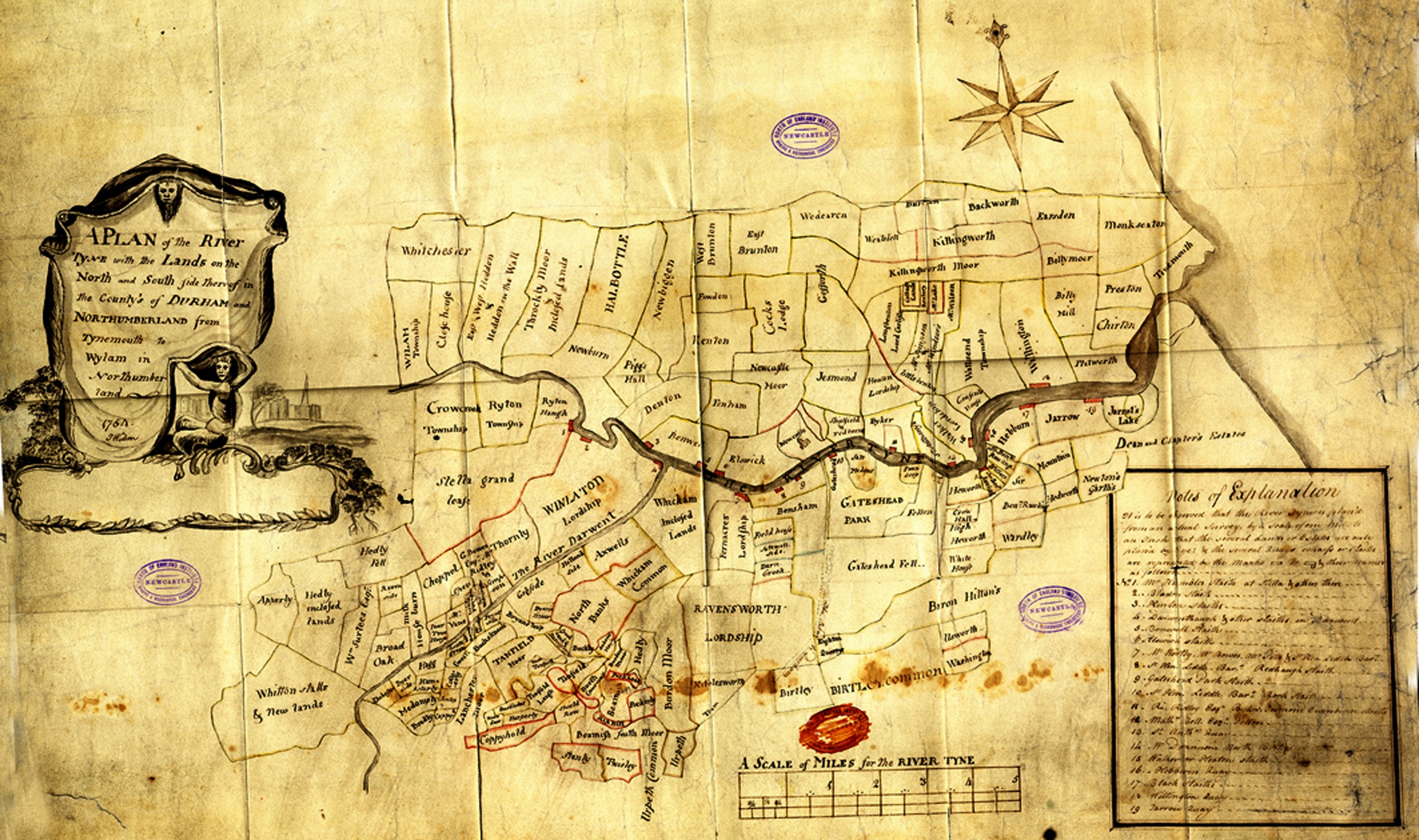
2) Plan of the River Tyne in 1754 by T. Wilson showing royalties in Northumberland and Durham and staiths and quays along the river (NEIMME: SR 410-164 Wil.). The note of explanation reads: 1. Mr Humble’s staith at Stella and others there; 2. Bladon staith; 3. Kenton staiths; 4. Derwenthaugh and other staiths in Darwent; 5. Benwell staith: 6. Elswick staith; 7. Mr Wortley, Mr Bowes, Mr Pitts and Sir Henry Liddle Bart; 8. Sir Henry Liddle Bart. Redheugh staith; 9. Gateshead Park staith; 10. Sir Henry Liddle Bart. Rock staith; 11. Richard Ridley Esq. Byker, Jesmond, Owesburn staiths; 12. Math. Bell Esq., Fellon; 13. St. Anthonys Quay; 14. William Donnisons North Birtley; 15. Walker or Heaton staith; 16. Hebburn Quay; 17. Black staiths; 18. Willington Quay; 19. Jarrow Quay.
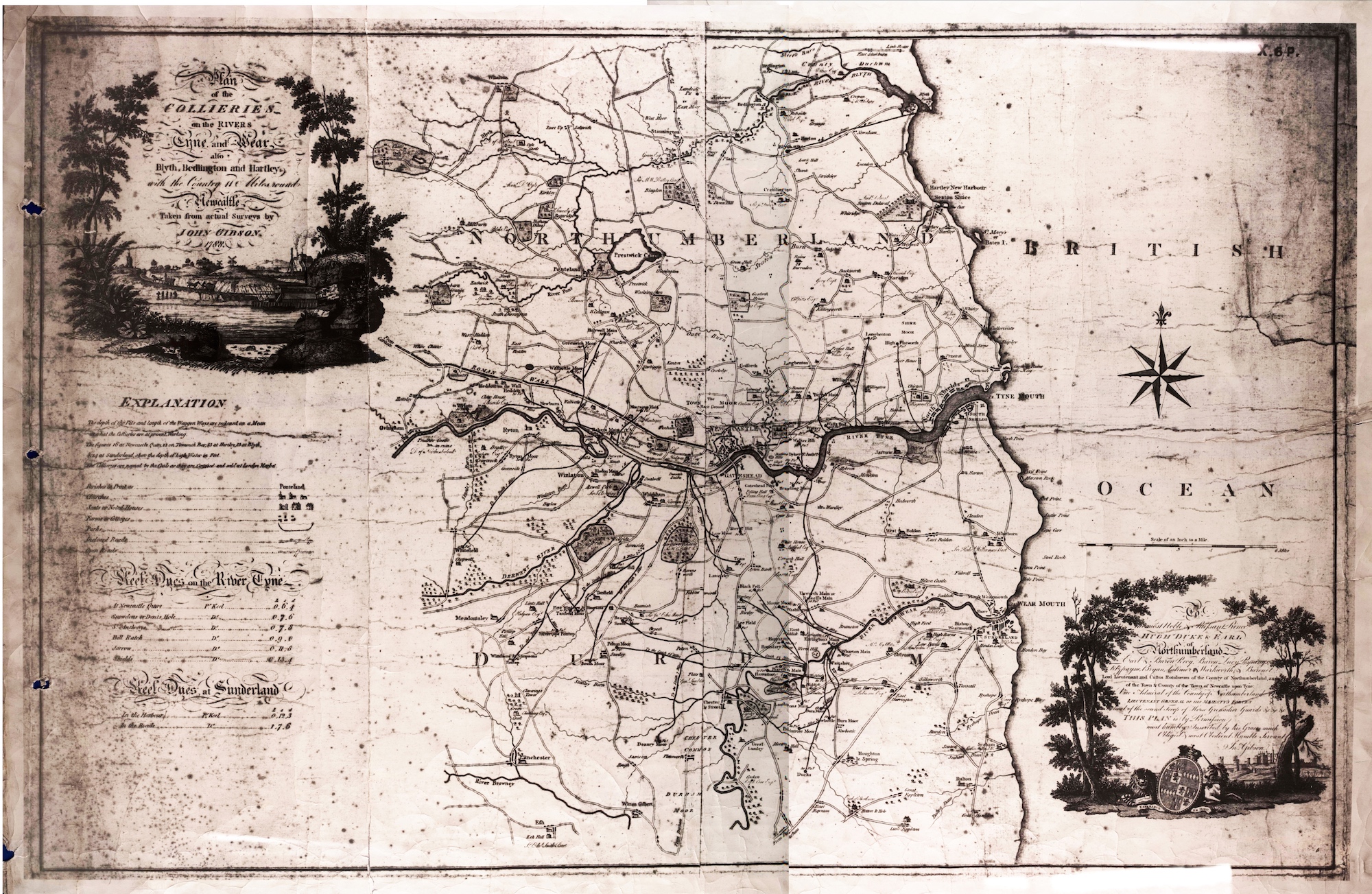
(3) Plan of the Collieries on the Rivers Tyne and Wear in 1788 by John Gibson. The first edition was in 1787 and was only different in a few minor details.
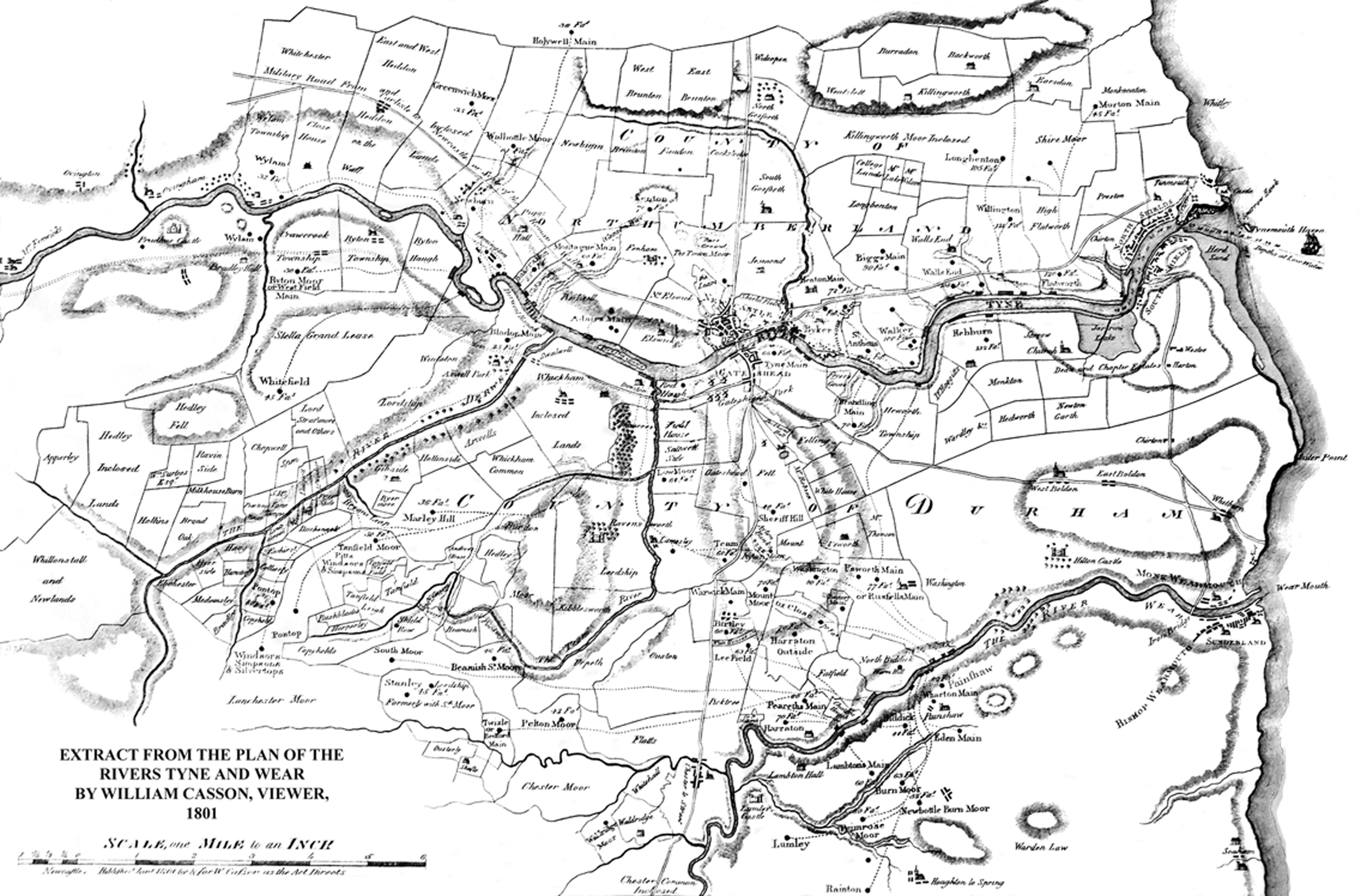
(4) Plan of the Rivers Tyne and Wear in 1801 by William Casson.
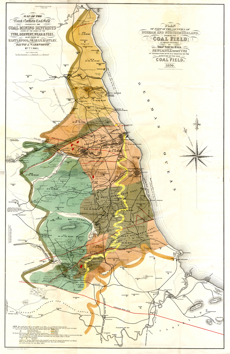
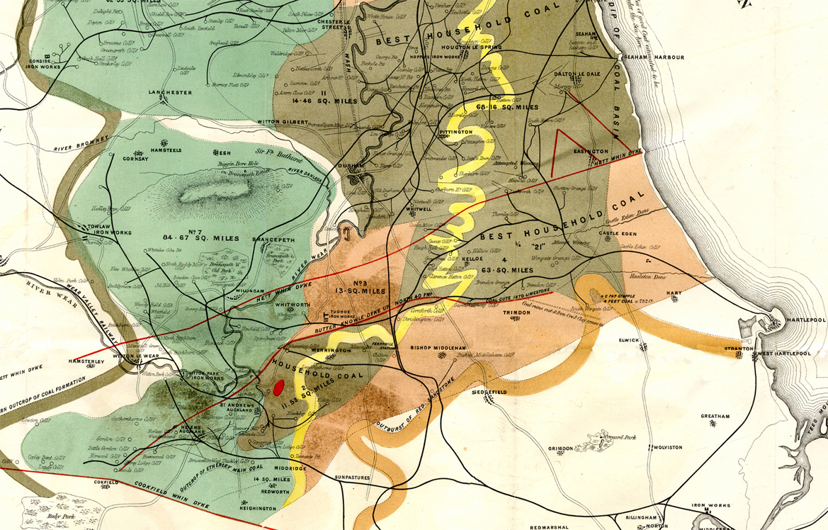
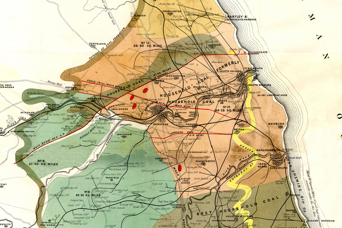

(5) Plan of the Northumberland and Durham Coalfield in 1854 by Thomas Young Hall.
(6) John Thomas William Bell’s Plans of the Northumberland and Durham Coalfield, 1842-61.
(7) Other Maps.
The first and second editions of the Ordnance Survey maps are available through the website of the National Library of Scotland.
The following maps are available through the website of Durham Mining Museum:
- Plan of the Rivers Tyne and Wear in 1807 by Akenhead,
- Reid’s Handy Colliery Guide 1898,
- Reid’s Handy Colliery Guide 1928,
- Colliery Guardian Guide to the Coalfield Northern Division 1951,
- Colliery Guardian Guide to the Coalfield Durham 1951.


